
Struve arc (item “Tyupishki”)
Landmark
Belarus, Oshmyany district, village Tyupishki
Description
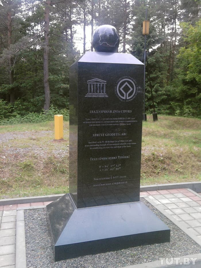
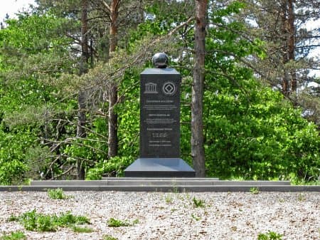
One of the points of the Struve geodetic arc, located on the territory of Belarus, included in the UNESCO World Heritage List. Located in the Oshmyany district, near the village of Tyupishki.
The Struve geodetic arc is a degree measurement of the Earth, a chain of 265 triangulation points stretching more than 2820 kilometers from the city of Hammerfest, Norway to the Black Sea coast. The measurement was carried out to determine the parameters of the Earth, its shape and size. Named after the main leader - the Russian astronomer Friedrich Georg Wilhelm Struve (Vasily Yakovlevich Struve). It was created in the territories of the Swedish-Norwegian Union and the Russian Empire in the 19th century.
Categories
Historical
UNESCO
Comments
Reviews to the Place
1С Н
30.04.2024
Geodetic point “Tyupishki” by Struve Arc
What is the Struve Arc?
The Struve arc is the longest geodetic instrument, a chain of 258 triangles with a common side (265 triangulation points in total). It starts in Norway and ends in Ukraine, passing through the territory of ten countries. The arc was built in the mid-19th century to create accurate maps of the area and prove that the Earth is not a sphere, but an ellipsoid oblate on both sides. The measurements were carried out on the lands of the Russian Empire and the Swedish-Norwegian Union, and the arc was named after the project leader on the Russian side, astronomer Friedrich Georg Wilhelm Struve.
The geodetic arc was laid for 2820 kilometers from north to south along the 25-degree meridian of eastern longitude. It makes up one-fourteenth of the Earth's circumference. The points of the arc were marked in different ways - these were iron crosses, stone pyramids, recesses carved into the rock, granite obelisks. Monuments were erected at the starting and ending points: the Fuglenes point is located near the Norwegian city of Hammerfest, the Staro-Nekrasovka point is near the Ukrainian city of Izmail.
Using geodetic points, angular measurements were made, thanks to which they calculated the size of the Earth and proved that it has the shape of an ellipsoid. For the 19th century, this was an incredibly progressive tool: it required precise selection of points, correct reconnaissance and careful measurements.
UNESCO.
In 1993, Finland took the initiative to give the arc the status of a UNESCO World Heritage Site. The project was prepared for more than ten years: we looked for points, collected and studied information from different countries. As a result, we chose 34 items that were best preserved. In 2005 they were included in the World Heritage List. The basis was such criteria as huge geographical coverage, high accuracy of measurements, international nature of the study, and unique tools.
In terms of its importance for geodesy, the Struve arc can be compared with the periodic table for chemistry. It became the basis for the most important earth measurements and precise cartography, and the triangulation method was used until the end of the 20th century, until space satellites appeared.
Struve arc in Belarus
There were 31 arc points on the territory of Belarus. Now 22 of them have been found - no other country has such a number of points. They are located in the Grodno and Brest regions.
Five Belarusian geodetic points are included in the UNESCO World Heritage List:
point “Tyupishki” (village Tyupishki, Oshmyany district, Grodno region);
point “Lopaty” (village of Lopaty, Shchuchinsky district, Grodno region);
point “Chekutsk” (village of Shchekotsk, Ivanovo district, Brest region);
point “Leskovichi” (village Lyaskovichi, Ivanovo district, Brest region);
point “Osovnitsa” (village Osovnitsa, Ivanovo district, Brest region).
All Belarusian points of the Struve Arc are an end-to-end metal pyramid, next to which stands a one and a half meter obelisk, topped with a “terrestrial” globe with the outline of Belarus.
In the village of Golshany, Grodno region, a museum called “The Arc Uniting Peoples and Cultures” has been operating on the basis of the village library since 2012. There you can see maps and books dedicated to Struve’s arc, as well as portraits of its creators.